SEBIOREF
|
Article Scientifique M. Fauvel, M. Lopes, ..., A. Ouin Prediction of plant diversity in grasslands using Sentinel-1 and -2 satellite image time series Remote Sensing of Environment, 2020, 237, 111536. The prediction of grasslands plant diversity using satellite image time series is considered in this article. Fifteen months of freely available Sentinel optical and radar data were used to predict taxonomic and functional diversity at the pixel scale (10m 10 m) over a large geographical extent (40,000 km2). 415 field measurements were collected in 83 grasslands to train and validate several statistical learning methods. The objective was to link the satellite spectro-temporal data to the plant diversity indices. Among the several diversity indices tested, Simpson and Shannon indices were best predicted with a coefficient of determination around 0.4 using a Random Forest predictor and Sentinel-2 data. The use of Sentinel-1 data was not found to improve significantly the prediction accuracy. Using the Random Forest algorithm and the Sentinel-2 time series, the prediction of the Simpson index was performed. The resulting map highlights the intra-parcel variability and demonstrates the capacity of satellite image time series to monitor grasslands plant taxonomic diversity from an ecological viewpoint.Keywords: Satellite image time series, Sentinel-1 & -2, Statistical learning, Grasslands taxonomic diversity A consulter ici : https://www.sciencedirect.com/science/article/pii/S0034425719305553 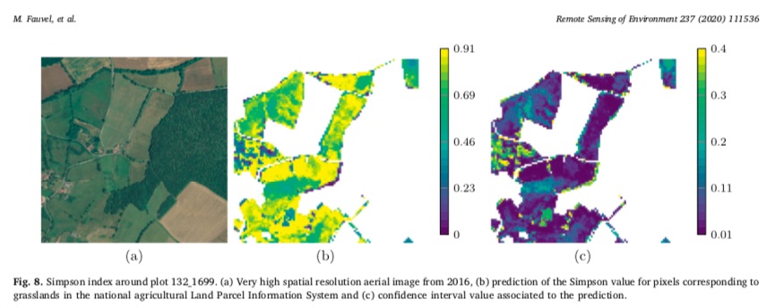 |